
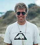
 Professor Karl Wirth, geology, took his class Field Methods in Geology to Thomson, Minnesota, for a field mapping project in early October.
This course introduces students to the methods of collecting, recording, and presenting field data. The field scientist must know how to extract and record data from complex environs. Field data often involve spatial components, so the interpretation and generation of maps are essential skills, including the use of global positioning data, and satellite imagery. Outdoor mapping projects is conducted during the early and middle part of the semester, followed by computer-aided mapping and analysis during late fall. Mapping is initially conducted on campus (pace and compass map), followed by projects at Mounds Park (GPS), Minnehaha Falls Park (aerial photograph mapping and stratigraphic section), and Thomson Falls park (detailed geologic/biologic mapping).
Upon completion of the course, students will:
- know how to make detailed field observations and maintain a field notebook
- be familiar with use of field equipment (e.g., Brunton Compass, Jacob Staff, GPS, total station, topographic maps, and aerial photographs)
- understand map projections, grid systems, datums, scale, and magnetic declination
- have enhanced 3-D visualization and spatial analysis skills
- know how to plan and prepare maps at a variety of scales and for a variety of purposes
- understand concepts of error, accuracy, and precision as they relate to spatial data
- be familiar with the use of graphics software to prepare publication quality maps
- know how to locate the resources related to maps, mapping, and field research
Professor Wirth is an igneous petrologist and his research interests include ophiolite studies in Alaska, lava flow suites in the Philippine Islands, Mafic Dikes in northern and southwestern Minnesota and Antarctic meteorites.
October 25 2010
Back to topMore Academics News

Global Citizenship Student Awards 2024
Seniors Hufsa Ahmed, Uditi Chandrashekhar, and Anika Brennan receive 2024 Global Citizenship Student Awards

Anthropology professor co-authors new book about the history and evolution of human infectious diseases
The second edition of Emerging Infections: Three Epidemiological Transitions from Prehistory to the Present is one of first comprehensive syntheses of both the societal and environmental drivers of infectious diseases in humans.

Macalester professor’s new research offers the first-ever look at growth rates in the oldest-known dinosaurs

Student Innovators Share Their January 2024 Live It Fund Experiences
The 2024 Live It Fund saw students propose innovative solutions to unique problems or issues around the globe.

Macalester Senior Awarded 2024 Watson Fellowship
Chloe Vasquez ʼ24 will use her Thomas J. Watson Fellowship to research snake bites and medical care in tropical areas.

Publishing with Professors: Student-Faculty Research Collaborations
Collection of faculty-student research published in academic journals, magazines, and news outlets from March 2022—December 2023.