Maps & Directions
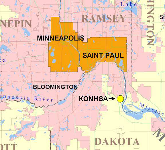
Map Showing Ordway in Relation to the Twin Cities
9550 Inver Grove Trail (Google map)
Inver Grove Heights, MN 55076
From Macalester College
- Drive east on St. Clair Ave. about 1 mile and turn right on to Ayd Mill Road.
- Continue south on Ayd Mill Road until it merges with Interstate I-35E, about 1 mile.
- Continue south on I-35E for several miles, crossing the Mississippi River.
- Take exit 98 for Lone Oak Road (County Rd 26) and take a left (head east) on Lone Oak Road.
- Continue on Lone Oak Road for about two miles until you get to MN-55.
- Turn right on MN-55 and continue for about 5 miles (MN-55 will merge into US-52).
- Take the Concord exit and go east on Concord (under MN-55/US-52) for about half a mile.
- Turn right on Cahill Ave S. Continue for about 0.75 miles until Cahill runs into Inver Grove Trail.
- Turn left on Inver Grove Trail and continue for about a quarter of a mile.
- Turn right into the field station’s driveway.
From West on I-94
- Take exit 242D to merge onto US-52 S and drive south for 11.5 miles (MN-55 will merge into US-52).
- Take the Concord Blvd (County Road 56) exit and go east on Concord (under MN-55/US-52) for about half a mile.
- Turn right on Cahill Ave S. Continue for about 0.75 miles until Cahill runs into Inver Grove Trail.
- Turn left on Inver Grove Trail and continue for about a quarter of a mile.
- Turn right into the field station’s driveway.
From the East on I-94
- Take exit 242D to merge onto US-52 S and drive south for about 11 miles (MN-55 will merge into US-52).
- Take the Concord Blvd (County Road 56) exit and go east on Concord (under MN-55/US-52) for about half a mile.
- Turn right on Cahill Ave S. Continue for about 0.75 miles until Cahill runs into Inver Grove Trail.
- Turn left on Inver Grove Trail and continue for about a quarter of a mile.
- Turn right into the field station’s driveway.
From the North on I-35E
- Take the exit onto I-35E S/US-10 E toward St. Paul.
- Continue onto US-10 E (signs for US-52 S/I-94 E) for 0.6 miles.
- Then take exit 242D to merge onto US-52 S and drive south for about 11 miles (MN-55 will merge into US-52).
- Take the Concord Blvd (County Road 56) exit and go east on Concord (under MN-55/US-52) for about half a mile.
- Turn right on Cahill Ave S. Continue for about 0.75 miles until Cahill runs into Inver Grove Trail.
- Turn left on Inver Grove Trail and continue for about a quarter of a mile.
- Turn right into the field station’s driveway.
From the South on US-52
- Take the Concord Blvd (County Road 56) exit and go east on Concord for about half a mile.
- Turn right on Cahill Ave S. Continue for about 0.75 miles until Cahill runs into Inver Grove Trail.
- Turn left on Inver Grove Trail and continue for about a quarter of a mile.
- Turn right into the field station’s driveway.